
I’m kind of stupid. My wife tells me I’m the smartest stupid person she knows. Or the stupidest smart person, I can’t remember. Like I said—kinda stupid. There’s a lot of fun to be had, however, by making stupid decisions. Sometimes, the way things end up turning out is the best way. The most recent stupid thing I did was decide to ride a relatively new (to me) bike 600 miles from Sebastopol to Los Angeles, CA.
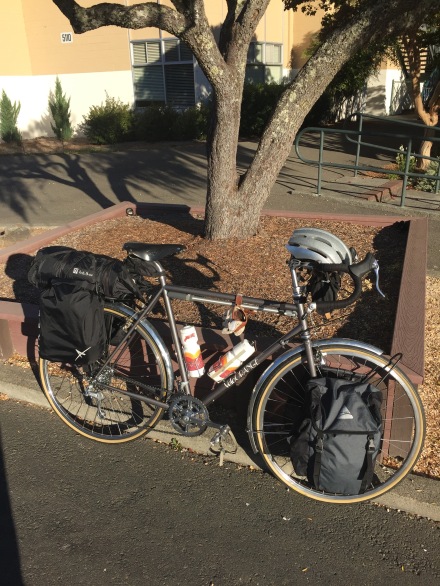
I’d been riding an old Bridgestone in LA for three months, making sure everything was ready for my trip. But when I got to Sonoma County, I found a great deal on a new Velo Orange Campeur frame, which has been my dream touring frame for a long time. I swapped my old parts out onto the new frame with the help of a bike mechanic friend, but everything was just slightly different . I also decided to get a very bad head cold a week before I was supposed to leave, so I spent a week in Sonoma County not riding, barely getting better, and scrambling to put all the pieces on my bike before it was time to leave. I ended up leaving two days later than scheduled, and the longest I’d ridden the bike that I was going to ride all the way to LA was about 7 miles.
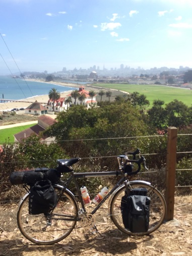
I got a ride to a church in rural west Sonoma County—having grown up in the area, I had no desire to ride fully loaded for an extra ten miles through well-ridden and familiar terrain. My dad dropped me off, I double-checked all the straps and bags, and I was on my way.
Riding a bike that weighs about 50 pounds loaded after not being the saddle for almost two weeks prior is not easy. My gearing was new to me, and I was immediately surprised at how low I needed to keep it in order to keep my legs moving. I was also surprised at how much more frequently I wanted to change gears—little inclines with a bunch of extra weight make a huge difference. I tried to remember all this from a similar ride I had done, but that was 7 years and a whole lifetime earlier. I enthusiastically pulled into my first stop—my friend’s parents’ house, which is about 3 miles from where I started. I ate some fruit, visited with my friend who was in town for the week, and finally headed out for real.
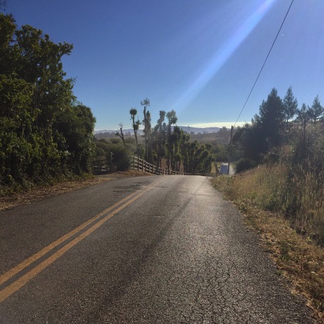
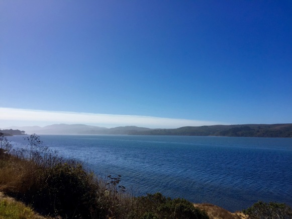
Riding out to the coast through the backroads of Sonoma County was a strange blend of nostalgia and excitement. I had driven a similar route many times, and even walked it once. I rode old Schwinns over some of these roads when I was nine or ten, trailing far behind my mom and complaining about how hard and long the ride was. It was funny to see how short, easy, and pleasant those rides actually were now that I had long legs and a real bike.
My “real” first stop was going to be the town of Tomales, where I remembered having eaten a great sandwich about 15 years ago. I arrived earlier than I expected—Tomales was a whole county away, and as a young person it felt like a very different place. I had fantasies of arriving sweaty, starving, and devouring a delicious sandwich while local club riders ogled my bike and admired the distance and audacity of my journey ahead. But I was instead served a mediocre sandwich by someone who was more interested in the soft-core telenovela playing behind the counter than anything that was happening in the real world. A few fast bikers rode past, as well as two tourers (who I would later find out were on the coast route), but I was mostly alone.
I had planned to head straight to Pt Reyes Station where I would grab lunch and supplies for dinner, but when I got to Marshall I knew I should take the opportunity to indulge myself and eat a bunch of Hog Island Oysters.
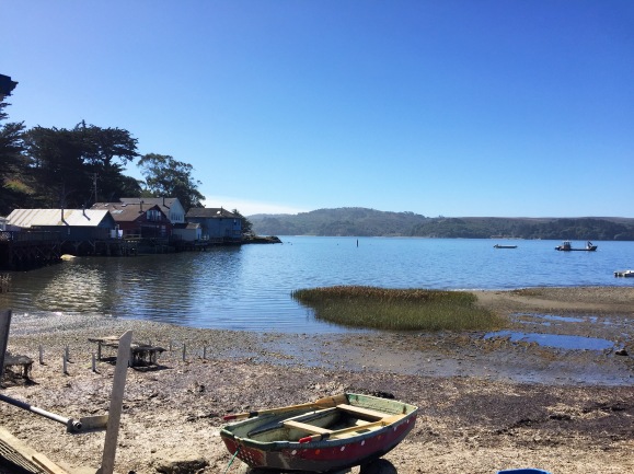
Again, I wasn’t as tired or starving as I should have been, but one cannot always plan the proper distance between can’t-miss food opportunities! I devoured some oysters, blew my nose a few times (I was basically recovering from my cold until about 3 days before the end of my trip), and headed into Pt. Reyes Station, the town in which I’d spent the first six years of my life.
Along the way I caught up to one of the tourers I’d seen in Tomales. Now it felt like I was really on a bike trip. I rode alongside him and we chatted for a while. He was from Australia, had been living in Vancouver, and was riding form there to Mexico, where he was hitching a ride with a friend back up north. It turned out he was going to sleep in the same State Park as I was that night. I left him in town and rode around a bit, visiting my old preschool and the familiar sights. I honeymooned nearby three months earlier, so it wasn’t the overwhelming nostalgic rush that it could have been, but it was great to visit again. The two places I was most interested in visiting—Black Mountain Cycles and Cowgirl Creamery—were each closed on Monday, so there wasn’t much to do but visit the Old Western Saloon (the first bar I ever saw, and still what comes to mind when I imagine a prototypical bar) and stock up at the Palace Market.
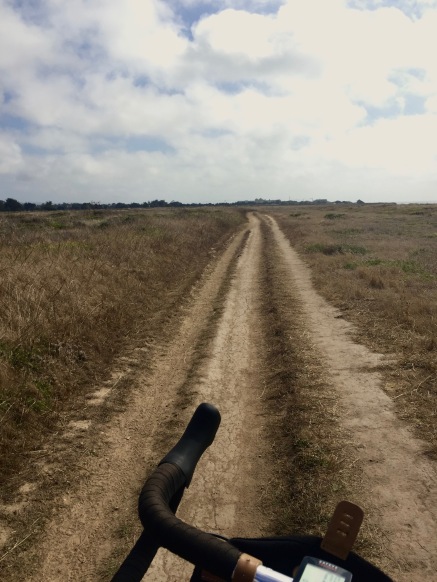
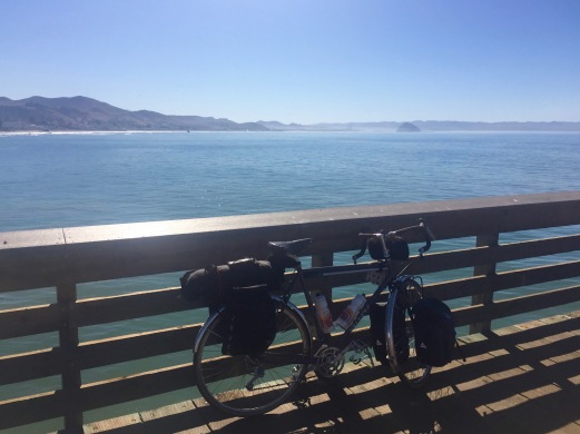
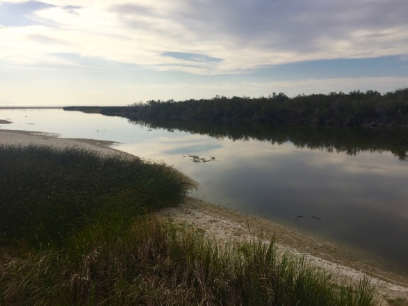
After an hour or so I headed out of town. I only had 6 miles or so until the campsite and I didn’t want to get there too early. My first two days were short ones—40 miles each—and since I was traveling alone there wasn’t a ton of fun to be had once I reached camp. I pedaled over the Olema Grade and got on the Samuel P. Taylor bike path. I knew that this path was supposedly closed, but I decided to ride it anyway, because my parents and I used to ride it when I still had training wheels on my red Rallye. It turned out to be sort of stupid—about a mile and a half in I had to turn around, head back to the road, and continue along the main road to the campsite. The bike path usually leads directly to the campground in the woods, and my fantasy of riding this childhood route to a magical forest glen was shattered by a man in a dumptruck.
I was the first one at the campsite, and found a nice spot for my tent. I settled in with a book and waiting for Pete to arrive. Not only did Pete show up, but Wally (the other guy I had seen in Tomales—from New Zealand), Robbie, Bill, and Nick stopped there as well. Everyone was on a trip that put mine to shame. Wally was also riding form Canada to Mexico, Robbie had ridden from North Carolina to Seattle and was now headed down the coast, completing his trip the next day in San Francisco, Bill said he “lived on his bike” and was finishing a four month loop through the American West, and even Nick—who pulled in when it was almost dark after riding from Salt Point in Mendocino County—was riding from northern Oregon to San Francisco. I was on my first day and on a baby trip compared to everyone else. Oh well. At least it gave me some perspective.
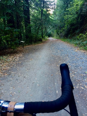
The road out of Samuel P Taylor Park is one of the finest riding paths I’ve been on. It starts out as a paved bike path meandering up Papermill Creek through some very woodsy woods, and quickly evolves into a gravel and dirt path that is easy to ride with 28cm tires but lets you feel like you’re really out there.
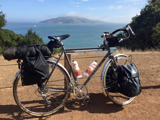
I did the first stupid thing of my second day when I sliced open my finger trying to fix my sunglasses. I bled a lot, and was glad for the toilet paper that my dad had suggested I bring. After getting bandaged up I rode over the first “big” hill of my trip—a meager 250 foot climb over the Woodacre pass. I flew down the hill to Fairfax, passing and barely noticing the Mountain Bike Museum along the way. My goal that day was San Francisco, where I would be able to eat some good food, swap out my 100mm stem for a 60mm I was dragging around with me, and see and stay with my friend who makes whiskey. The ride through Fairfax to the Golden Gate Bridge is pleasant enough, with well-marked bike lanes and paths that allow you to avoid most of the commuter hell that is Marin County. I ran into and rode with Pete and Wayne along the way, as well as a couple fast riders from Ireland (Scotland?) who were headed back to the city. As I rode up the Sausalito headlands, I was greeted by the beautiful sunny North Bay,
as well as the foggy bridge.
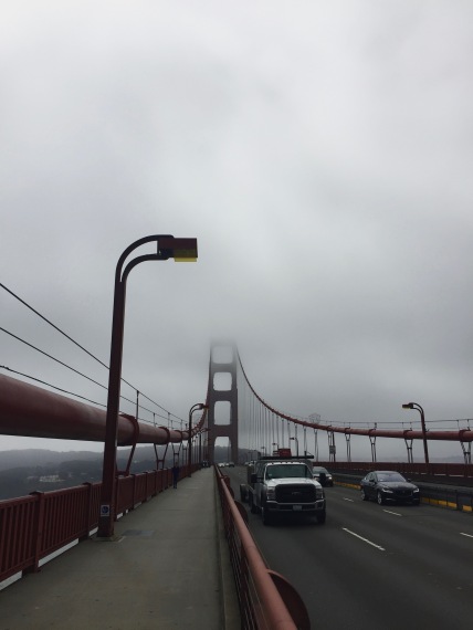
Even though I grew up in the Bay Area, it was my first time crossing the bridge other than by car. It was a special experience, and although it sort of reminded me of the worst parts of riding over the Brooklyn Bridge (too many tourists, pedestrians, and unexperienced bike riders, thanks to Blazin’ Saddles), I enjoyed it. The hill up to it from Fort Baker is a serious mother fucker though!
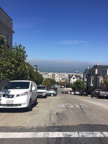
I had planned to keep to the coast in San Francisco, avoiding all the unnecessary hills, remaining in the sun, and indulging in the touristy Fisherman’s Wharf, Embarcadero, and Ferry Building. However, once I got into the city, I decided just to follow whatever path through the Presidio looked most pleasant. This, of course, got me stuck between a hill and a steep place, and I ended up climbing one of the steepest roads in the city, which was very stupid.
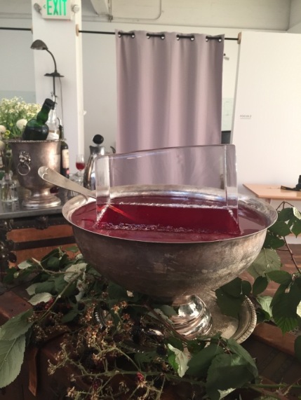
Lungs and limbs aching, I headed to American Cyclery on Haight, where they kindly swapped out my stem, even though I could have easily done it myself and saved a bunch of money, but I was just feeling too stupid and lazy. I reasoned that keeping my bike in the shop for a few hours would provide “free” secure bike parking while I wandered the city waiting for my friend to be off work, and I thoroughly enjoyed one of the worst hamburgers I’ve ever had in the meantime (hunger is an amazing spice). I had a feeling that I would run into Nick from the night before on Haight Street, and expectations didn’t disappoint. I met up with my friend around 5, who gave me a change of clothes and took me to a fancy party with free food and drinks, which was just perfect. There was fried chicken on a stick and punch in a bowl with a giant ice cube and mescal manhattans and espresso drinks and it was all perfect.
We went back to his apartment, drank some more scotch, and slept together in his top bunk.
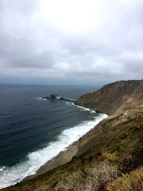
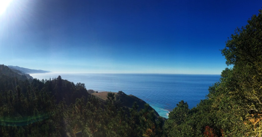
I awoke with a headache, had a terrible breakfast with a good old friend from college, ate a better croissant and had some good coffee, mailed some excess stuff to myself (a tire, my 100mm stem, and the book I had just finished), and rode through the city toward the beach. It was beautiful urban riders. I took “The Wiggle,” a bike route from the Mission to Golden Gate Park that avoids the hills, and was accompanied commuters and tourists. San Francisco was lovely this visit, a glorious gem who showed me a lot of her true colors. I rode down the Great Highway, up a rather surprising hill in Daly City, and screamed down through some neighborhoods to the coast. I reunited with Highway 1, had some fish and chips and coffee, and began the climb to Devil’s Slide. This stretch of the road was frequently and notoriously closed due to rockslides and mudslides until they built a tunnel through the mountain that avoided it altogether. Now it is open only to bicycles and pedestrians, and it was magnificent. A hard climb to the top was met with spectacular views of the Northern California coast and followed by a screaming descent on untrafficked roads.
A tailwind carried me to Half Moon Bay, where I had the pleasure of finding another bike path. This took me along the coast and through a regional park, but it quickly turned from paved bike path into packed singletrack and I was severely underbiking on by 28c tires, although I was smiling the whole time.
I eventually made it back to the PCH and continued to Stage Road, which was the perhaps my favorite detour of the entire trip. From the top of one of the many (many) small hills along Highway 1, this winding country road (presumably an old stagecoach route) leads down to San Gregorio, a small hamlet that has a bar/general store/grocery store/post office combo and that’s it. There were some salmon carcasses hanging from a fence nearby and apparently Neil Young lives (or lived) there. From there it was am beautiful 10 mile ride with two climbs over some freshly paved, barely traveled coastal country road. It was fun, challenging, remote, and beautiful—all the best things about riding bikes!
Earlier I had gotten in touch with the kind people at the McCormick House Inn in Pescadero. They had graciously agreed to let me pitch a tent in their yard while I was riding through town, which was incredibly helpful.
Pescadero is about the perfect distance for a day’s ride from SF—55—but there are no official campsites nearby. Thanks to the McCormick House, I was able to spend the evening in the charming town of Pescadero, have some amazing Olallieberry pie,
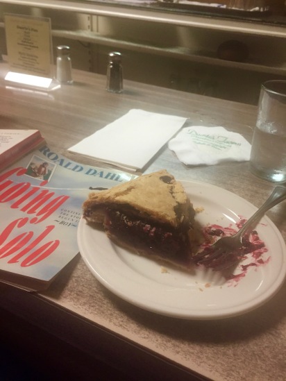
eat in the tavern, and have delicious coffee and pastries at the hippest coffee shop I’ve ever been to. And other than pretending I was a mountain biker for a little while in Half Moon Bay, I didn’t do anything stupid all day!
The next morning I continued my backroad detour by going east just a bit on Pescadero Creek road and then turning south down Cloverdale road. After passing Butano State Park the road turns into a windy one lane affair, meandering along a creek with a few little climbs and a nice downward lilt to the coast. You miss Pigeon Point Lighthouse going this way, but if you’ve seen one lighthouse you’ve seen them all, right?
After an abortive attempt at glimpsing elephant seals at Ano Nuevo Park and a much-too-big breakfast at noon in Davenport, I arrived in Santa Cruz too full for lunch but eager to visit Caffé Pergolesi, one of my favorite spots in town.
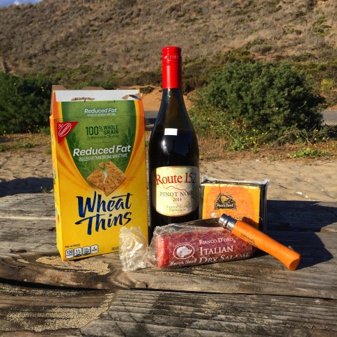
I had almost 20 miles until I reached my campsite for the night, and I was tired. I saddled up and rode to a corner store about 5 miles from the State Park, where I spent a ridiculous amount of money on snacks and dinner for that night. The hardest 5 miles of the trip came after that stop, but I eventually pulled into Sunset Beach State Park, where I had the hiker/biker camp to myself, ate salami, cheese, and crackers at the beach, and relaxed.
By this time I was starting to feel like I was really on a bike trip. The soreness in my quads had finally given way to soreness everywhere else, I was dirty, smelly, pretty much out of clean clothes, starting to grow as much of a beard as I can, and not giving much thought to the route or roads anymore. I drifted south through Moss Landing, watching otters play and ogling the cheap avocados. Through misty Seaside and Monterrey until I found myself climbing a big hill that cuts 17 miles off the ride and crosses the ridge between Monterrey and Carmel. At the bottom of the hill I ate fried chicken from Safeway, drank two coffees from Starbucks, charged my phone, and tried to amp myself up for the 24 miles and 1700 vertical feet I had left between myself and Big Sur.
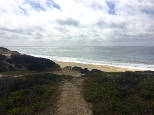
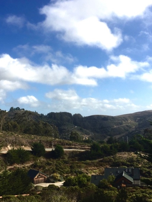
That was the night I didn’t know where I was going to sleep. I had planned on camping at Pfeiffer Big Sur State Park, but it was closed due to a fire that had burned a few months before and was still wrapping up. Normally that would be fine—I could just sleep anywhere in the National Forest. But that was closed too! The Henry Miller Library wouldn’t let me sleep in their yard, and the private campsites I’d seen were $60, even for a biker. I decided I’d just wing it—always a good plan. Once I got to the coast, near Carmel Highlands, the riding became so easy because it was just stunning. Each bend, hill, descent, and curve was just right for biking.
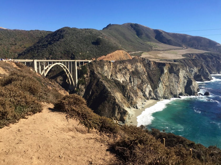
I wanted to stop at every turnout, but I resisted the urge for the most part. I got to ride by that bridge that you always see in car commercials, I climbed a bluff that was 750 feet above the sea crashing below, and I sped right back down with no cars behind me, finding perfect lines in the road.
When I was nearly out of water, I stopped at Andrew Molera State Park and a fireman gave me Gatorade and ice cold water out of his cooler. Then, just when the day couldn’t get better, I met a couple bike tourists who were going SF to LA (Yay, finally someone whose trip was—slightly—shorter than mine!), and they told me about a back way into the closed State Park. I found the Visitor Center which was thankfully closed and located the trail which supposedly led down to the campsite. I was skeptical—it looked like the path would lead UP, not down, but I rode on it a little ways, losing a bungee cord in the process. The path led along the backyards of some houses, which I assumed belonged to the park service, so I sprinted along to get out of view as fast as possible. Then the path forked—one branch leading up to some hot springs, and the other going down to the campsite!
Pfeiffer Big Sur State park is one of the busiest I’ve been to. Reservations are needed weeks, if not months, in advance, and it is always loud, crowded, and sort of smelly. When I got down there, no one was there (or so I thought). I had the entire place to myself. I could pick ANY campsite I wanted. Literally. I could hardly believe it. I stashed my bike out of sight from the road and lay my sleeping bag (no tent here) down behind a large fallen redwood log. I washed up a bit and sat down with my dinner of snacks to read. After a while I heard a noise, and was shocked to see a jogger headed my way. I dove behind a log and I don’t think he or she saw me. I realized after further exploration that there must be some remnants of the fire crew camped out still. I decided to finish reading well out of sight of the road, and had an uneventful end to the evening.
After eating an overpriced breakfast at the State Park (the lodge was open) and sharing a table with a young grandmother and her grandson, I began the 1000-ft. climb to where Big Sur really begins–Nepenthe. I had a cup of coffee and then began the best 70 miles I think I’ve ever ridden.
Every hill and bend was more amazing than the last. You’d go from 500 feet above the ocean to riding along the beach and then dip into a little canyon before climbing back up over the sea. I didn’t get tired, I didn’t get too hot, I just wanted to keep riding. Even though it was Saturday, the traffic wasn’t bad. Riding Big Sur is something every cyclist should do once in their life, especially if you’re from California.
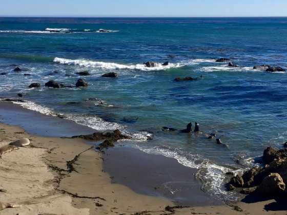
Towards the end of Big Sur the bluffs give way to more rolling plains as you approach San Simeon. Hearst Castle, with its herds of elk, zebra, and cattle, appears on your left, and you hear the barking of Elephant Seals just 5 miles before San Simeon.
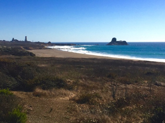
I had a Tri-Tip Sandwich and a glass of wine at Sebastian’s Store in Old San Simeon, then continued to the State Park Campground, which was a far cry from the first biker/hiker I stayed at. I shared the space with a couple nice Germans riding from Banff to Mexico and a bunch of annoying families from the Central Valley (I’m guessing…)
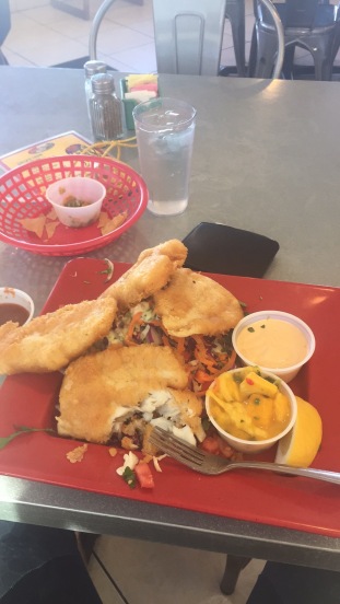
The next morning I had quiche, coffee cake, coffee, and more quiche in Cambria, and then pedaled to Morro Bay for fish tacos at a place called Taco Temple that I heard I had to try. Along the way I rode for a little while with a guy on a nice custom Steve Rex that he had got second hand, and stopped in Cayucos. But it was getting hot.Really really hot.
After Morro Bay I had what I thought was a short 12 miles to San Luis Obispo. But I missed the turn-off for the nice side road and ended up taking a 4-lane Highway 1 in 97-degree weather over a 10 mile hill that took over an hour. By the time I reached San Luis Obispo I headed for the nearest park and just sat still in the shade for about 20 minutes. Then I watched football and drank cider at a pub, recharging for another short (so I thought!) 18 mile ride to stay with a friend in Arroyo Grande. That was stupid. The cider tasted so good and felt so refreshing, but it was still 95 degrees outside when I left, and I had to ride over exposed hills and…well, it was actually really pretty. But I was tired and hot and ready to stop riding. I arrived at my friends’, took a much-need shower, and they took me whale-watching and then to dinner. It was a total success and well worth the hot day.
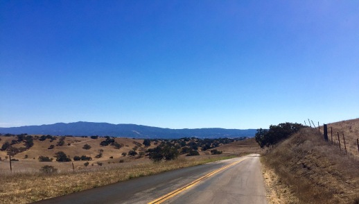
The next day, however, was even hotter. I started my ride with one of my friends, and we rode through 25 miles of agricultural and suburban wasteland. Flat, boring, smelly–definitely to be avoided if possible. I think the ACA should update their maps and get people to avoid the Coast Route from SLO to Lompoc and instead send them inland via Corbett Canyon Rd. and Foxen Canyon Rd., but I digress. Sort of. After the wasteland I got on Foxen Canyon Rd, and headed to the tiny hamlet of Sisquoc to buy a cold drink and refill my water at their general store. Of course, the store was closed, but fortunately I was able to get some water at a nearby elementary school. From Sisquoc I had 20 miles of uninhabited country road to Los Olivos with no services other than tasting rooms, and it was 99 degrees in the shade. I ate salami for lunch at a small chapel and pushed on.
The road was hot, long, and up a steady hill. But at least I was prepared, and I listened to music for this first time all trip to help get me up the hill. The downhills to Los Olivos were triumphant, and listening to Thin Lizzy as the hill ended, knowing I’d ridden almost 500 miles, and I was about to meet my wife in a hotel in Solvang, was pretty emotional.
Solvang. That is a weird town. It’s all this tacky retro fake Danish/Danish town with a disproportionate number of Asian tourists and it was HOT. My wife and I snuck into a pool, which was great because the hotel’s water was shut off when I arrived and I needed to get clean, and had good fried chicken in our hotel room. We might have gotten more bang for our buck at the nearby Chumash Casino, but it was a great stay.
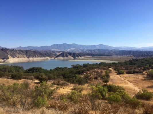
The next day I knew was going to be my longest day with the biggest climb. I gave my wife half my gear (I was only going to be gone one more night, so I got rid of the tent, warm clothes, and camp stove), kissed her goodbye, and pedaled off up a mountain. I passed Lake Cachuma on the way, and began to climb 2000 feet in under 6 miles.
It was hard, and long, and hot, and I missed a turn along the way that would have led to a harder–but prettier and quieter–old stagecoach road.
Water was scarce and there were no services, but I made it to the top all right. I knew I had a descent to look forward to, but I had no idea how great it would be.
I began speeding down the highway. My map had told me to turn off onto a “North San Marcos” road, which looked smaller and windier and I was worried that it might take some of the fun out of it. I hadn’t made up my mind, and I was still flying down the hill, but I saw some route arrows that had shared the road with me for the past few days, taking my detours and sidetracks, and they pointed towards the side road, so I decided to trust the arrows and take the risk. I was so glad that I did. I pulled off the road shortly after I got on to take in the view.
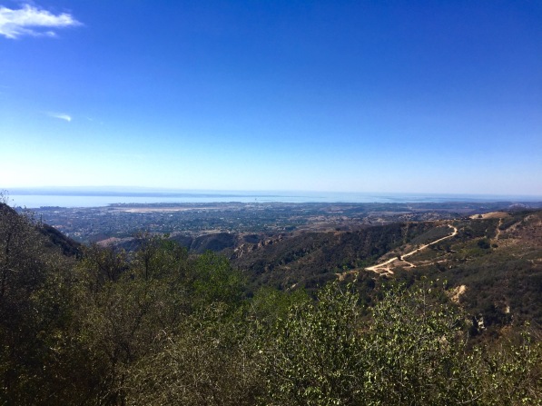
As soon as I got off the road I was passed by a group of maybe 40 riders on fast light bikes in red jerseys that said “Fireflies.” I had no idea who they were or what they were doing but I decided to ride down the hill with them, and it was probably the best descent I’ve ever ridden. No cars, steep grades, sharp turns, smooth pavement, and a pack of shiny redshirts to race. It was dreamy. After the hill I lunched in Santa Barbara and then rode to Carpenteria. There’s something weird about this stretch of road. I’ve ridden it both ways, north and south, and I swear its uphill each way with the wind blowing against you. Each time I’ve done it its been my least favorite part of the ride. But the good thing about riding is, you’re moving, so you’re not in the same place for that long, and all those shitty spots (as well as the good places) eventually end.
So I made it Carpenteria, and then, having ridden about 44 miles already, only had 44 miles to go to my campsite (yikes!) I had a few backups along the way–Emma Wood north of Ventura and McGrath in Oxnard. But Emma Wood came to soon, and I wanted to ride long the Ventura boardwalk and bike path. Once in Oxnard I caught a tailwind during a long straight stretch of southbound road, and passed McGrath noticing it was closed. So my mind was made up–I had to go to Point Mugu, which by now was maybe 20 miles away.
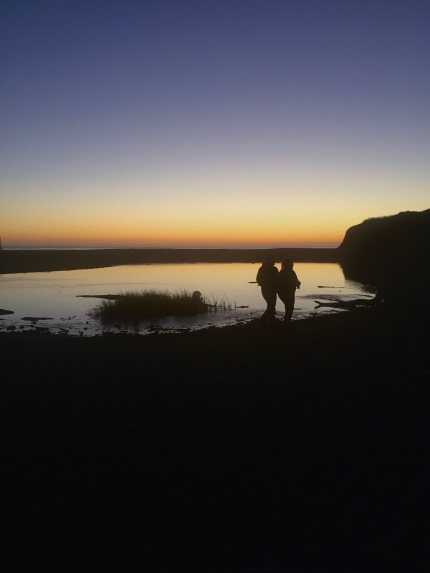
Somehow my legs decided to keep going, my aching back and ass didn’t complain to much, and I had a burrito in my panniers to look forward to. I arrived at Point Mugu just before sunset, there was no ranger in the kiosk and no water was available so I didn’t even feel bad about camping for free (plus this particular biker/hiker is $10!!!), and I changed out of my biking clothes, put on some comfy cotton, grabbed my burrito and some water, and ran to the beach to watch my least sunset and eat my dinner. It was worth it.
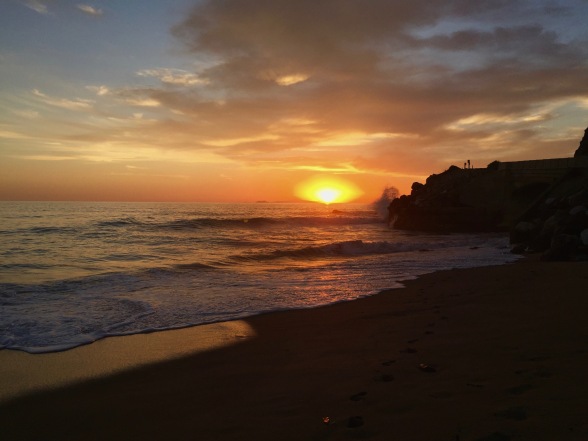
I slept outside, woke up early, and rode home as quickly as I could. The sunrise at Pt Mugu was spectacular, but beyond that the ride was somewhat ordinary. Malibu is nice when you’re coming from LA, but it’s nothing when you’ve just ridden from Sonoma County. I pushed through the last 45 miles averaging 14.7 mph (a record for tour, I think), and got home just around 1 pm. My odometer read 601 miles.
P.S. Every day or so, I would see a banana peel on the road. These progressively got fresher and fresher. I’m not sure if that was just a coincidence, but I liked to imagine that I was riding behind another cyclist who ate a banana every day and I was slowly catching up to them.
P.P.S. No flat tires! Thanks Rivendell’s Ruffy Tuffy’s

thanks for writing this up , and sharing . Great photos too. Tom T
LikeLike
This is one of the most engaging bike travelogues I’ve read. Well done, and thanks for the vicarious trip!
Philip
(Santa Rosa)
LikeLike